🇯🇪 Jersey
 National Flag
Geography & Borders
This country has no land borders.
Introduction & Background
Jersey (/ˈdʒɜːrzi/ JUR-zee, Template:IPA-fr; Template:Lang-nrf Template:IPA-all), officially the Bailiwick of Jersey (Template:Lang-fr; Jèrriais: Bailliage dé Jèrri), is an island country1112 and self-governing Crown Dependency13 near the coast of north-west France.14 It is the largest of the Channel Islands and is 14 miles (23km) from the Cotentin Peninsula in Normandy.15 The Bailiwick consists of the main island of Jersey and some surrounding uninhabited islands and rocks including Les Dirouilles,16 Les Écréhous,16 Les Minquiers,17 and Les Pierres de Lecq.18
Jersey was part of the Duchy of Normandy, whose dukes became kings of England from 1066. After Normandy was lost by the kings of England in the 13th century, and the ducal title surrendered to France, Jersey remained loyal to the English Crown, though it never became part of the Kingdom of England.
Geography & Climate
Temperature (2025)
Precipitation & Snow (2025)
Atmospheric Pressure (2025)
Thunderstorm Days (2025)
Wind Speed (2025)
Air Quality — Monthly Averages (2025)
| Metric | Jan | Feb | Mar | Apr | May | Jun | Jul | Aug | Sep | Oct | Nov | Dec |
|---|---|---|---|---|---|---|---|---|---|---|---|---|
| PM2.5 μg/m³ | 6.8 | 9.3 | 9.8 | 10.8 | 6.6 | 5.5 | 4.8 | 6.1 | 4.7 | 5.9 | 3.7 | 6.2 |
| PM10 μg/m³ | 11.9 | 14.3 | 14.3 | 15.3 | 12.3 | 10.5 | 9.8 | 12.6 | 11.7 | 13.3 | 11.5 | 13.5 |
| O₃ μg/m³ | 70.6 | 69.5 | 74.7 | 85.4 | 85 | 73.6 | 70.4 | 78.1 | 71.5 | 74 | 71.9 | 65.9 |
| NO₂ μg/m³ | 2.5 | 3.2 | 3.6 | 2.8 | 2.3 | 1.8 | 2.2 | 1.9 | 1.5 | 2 | 1.9 | 2.7 |
| SO₂ μg/m³ | 0.3 | 0.4 | 0.4 | 0.4 | 0.2 | 0.2 | 0.2 | 0.2 | 0.2 | 0.3 | 0.2 | 0.5 |
| CO μg/m³ | 172 | 197 | 178 | 166 | 134 | 135 | 126 | 143 | 137 | 134 | 130 | 146 |
Pollen Levels — Monthly (2025)
| Type | Jan | Feb | Mar | Apr | May | Jun | Jul | Aug | Sep | Oct | Nov | Dec |
|---|---|---|---|---|---|---|---|---|---|---|---|---|
| Grass | 0 | 0 | 0 | 0 | 2 | 8 | 3 | 1 | 0 | 0 | 0 | 0 |
| Birch | 0 | 0 | 2 | 25 | 2 | 0 | 0 | 0 | 0 | 0 | 0 | 0 |
| Alder | 0 | 0 | 3 | 0 | 0 | 0 | 0 | 0 | 0 | 0 | 0 | 0 |
| Ragweed | 0 | 0 | 0 | 0 | 0 | 0 | 0 | 0 | 0 | 0 | 0 | 0 |
| Mugwort | 0 | 0 | 0 | 0 | 0 | 0 | 1 | 0 | 0 | 0 | 0 | 0 |
| Olive | 0 | 0 | 0 | 0 | 0 | 0 | 0 | 0 | 0 | 0 | 0 | 0 |
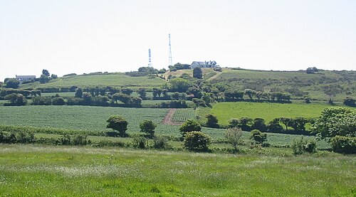
⛰️ Highest Elevation
- Map Locations: Google Maps | OpenStreetMap