🇧🇳 Brunei
 National Flag
Geography & Borders

Introduction & Background
Brunei (/bruːˈnaɪ/ⓘ broo-NY, Template:IPA-ms), formally Brunei Darussalamb (Template:Lang-ms, Jawi: نݢارا بروني دارالسلام, lit.'Nationof Brunei, theAbode of Peace'15), is a country located on the north coast of the island of Borneo in Southeast Asia. Apart from its South China Sea coast, it is completely surrounded by the Malaysian state of Sarawak. It is separated into two parts by the Sarawak district of Limbang. Brunei is the only sovereign state entirely on Borneo; the remainder of the island is divided between Malaysia and Indonesia. As of 2020update, its population was 460,345,9 of whom about 100,000 live in the capital and largest city, Bandar Seri Begawan. The government is an absolute monarchy ruled by its Sultan, entitled the Yang di-Pertuan, and implements a combination of English common law and sharia law, as well as general Islamic practices.
At the peak of the Bruneian Empire, Sultan Bolkiah (reigned 1485–1528) is claimed to have had control over most regions of Borneo, including modern-day Sarawak and Sabah, as well as the Sulu Archipelago off the northeast tip of Borneo, and the islands off the northwest tip of Borneo. Claims also state that they had control over Seludong (or the Kingdom of Maynila, where the modern-day Philippine capital Manila now stands) but Southeast Asian scholars believe this refers to a settlement Mount Selurong in Indonesia.16 The maritime state of Brunei was visited by Spain's Magellan Expedition in 1521 and fought against Spain in the 1578 Castilian War.
Geography & Climate
Temperature (2025)
Precipitation & Snow (2025)
Atmospheric Pressure (2025)
Thunderstorm Days (2025)
Wind Speed (2025)
Air Quality — Monthly Averages (2025)
| Metric | Jan | Feb | Mar | Apr | May | Jun | Jul | Aug | Sep | Oct | Nov | Dec |
|---|---|---|---|---|---|---|---|---|---|---|---|---|
| PM2.5 μg/m³ | 9.1 | 7.5 | 8.3 | 8.7 | 8.5 | 11 | 15.4 | 10.6 | 9.8 | 10.8 | 11.7 | 4.8 |
| PM10 μg/m³ | 9.6 | 8.4 | 9 | 9.1 | 9 | 12.1 | 16.6 | 11 | 10.3 | 11.5 | 12.1 | 5.1 |
| O₃ μg/m³ | 40.1 | 41.4 | 40.8 | 38 | 37.1 | 41.4 | 47.5 | 38.9 | 36.9 | 40.4 | 49.4 | 35.7 |
| NO₂ μg/m³ | 1.7 | 1.9 | 1.9 | 1.9 | 2 | 2 | 1.9 | 1.4 | 1.6 | 2 | 1.9 | 1.4 |
| SO₂ μg/m³ | 0.7 | 0.7 | 0.8 | 0.7 | 0.8 | 1 | 1.2 | 0.7 | 0.8 | 1.1 | 1.2 | 0.6 |
| CO μg/m³ | 187 | 178 | 178 | 168 | 164 | 184 | 239 | 178 | 165 | 160 | 218 | 155 |
Pollen Levels — Monthly (2025)
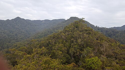
⛰️ Highest Elevation
- Map Locations: Google Maps | OpenStreetMap