🇿🇼 Zimbabwe
 National Flag
Geography & Borders


Introduction & Background
Zimbabwe (/zɪmˈbɑːbweɪ, -wi/), officially the Republic of Zimbabwe, is a landlocked country located in Southeast Africa, between the Zambezi and Limpopo Rivers, bordered by South Africa to the south, Botswana to the south-west, Zambia to the north, and Mozambique to the east. The capital and largest city is Harare. The second largest city is Bulawayo. A country of roughly 15 million people,14 Zimbabwe has 16 official languages,4 with English, Shona, and Ndebele the most common. Beginning in the 9th century, during its late Iron Age, the Bantu people (who would become the ethnic Shona) built the city-state of Great Zimbabwe which became one of the major African trade centres by the 11th century, controlling the gold, ivory and copper trades with the Swahili coast, which were connected to Arab and Indian states. By the mid 15th century, the city-state had been abandoned.15 From there, the Kingdom of Zimbabwe was established, followed by the Rozvi and Mutapa empires.
The British South Africa Company of Cecil Rhodes demarcated the Rhodesia region in 1890 when they conquered Mashonaland and later in 1893 Matabeleland after a fierce resistance by Matabele people known as the First Matabele War. Company rule ended in 1923 with the establishment of Southern Rhodesia as a self-governing British colony. In 1965, the white minority government unilaterally declared independence as Rhodesia. The state endured international isolation and a 15-year guerrilla war with black nationalist forces; this culminated in a peace agreement that established universal enfranchisement and de jure sovereignty as Zimbabwe in April 1980. Zimbabwe then joined the Commonwealth of Nations, from which it was suspended in 2002 for breaches of international law by its government under Robert Mugabe and from which it withdrew in December 2003.
Geography & Climate
Temperature (2025)
Precipitation & Snow (2025)
Atmospheric Pressure (2025)
Thunderstorm Days (2025)
Wind Speed (2025)
Air Quality — Monthly Averages (2025)
| Metric | Jan | Feb | Mar | Apr | May | Jun | Jul | Aug | Sep | Oct | Nov | Dec |
|---|---|---|---|---|---|---|---|---|---|---|---|---|
| PM2.5 μg/m³ | 9.1 | 10.6 | 10.5 | 10.1 | 11.6 | 18 | 16.8 | 20.3 | 23.4 | 15.6 | 12 | 9.5 |
| PM10 μg/m³ | 9.3 | 11 | 11.1 | 10.7 | 12.2 | 18.5 | 17.4 | 21.1 | 24 | 16.4 | 12.4 | 9.7 |
| O₃ μg/m³ | 48.2 | 41.4 | 45 | 51.4 | 57 | 66.7 | 66.8 | 87.3 | 106.9 | 87.5 | 62.1 | 49.5 |
| NO₂ μg/m³ | 3.4 | 4.6 | 3.9 | 3.2 | 3.4 | 4.9 | 4.3 | 4.6 | 3.8 | 2.6 | 3.6 | 3.8 |
| SO₂ μg/m³ | 0.6 | 0.7 | 0.6 | 0.7 | 1 | 1.8 | 1.5 | 1.5 | 1.2 | 0.7 | 0.6 | 0.6 |
| CO μg/m³ | 209 | 188 | 161 | 167 | 168 | 227 | 214 | 253 | 309 | 212 | 213 | 178 |
Pollen Levels — Monthly (2025)
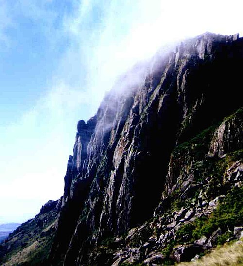
⛰️ Highest Elevation
- Map Locations: Google Maps | OpenStreetMap