🇲🇼 Malawi
 National Flag
Geography & Borders


Introduction & Background
Malawi (/məˈlɔːwi, məˈlɑːwi, ˈmæləwi/; Template:IPA-ny or [maláwi]; Tumbuka: Malaŵi),12 officially the Republic of Malawi, is a landlocked country in Southeastern Africa that was formerly known as Nyasaland. It is bordered by Zambia to the west, Tanzania to the north and northeast, and Mozambique to the east, south and southwest. Malawi spans over 118,484km2 (45,747sqmi) and has an estimated population of 19,431,566 (as of January 2021).13 Malawi's capital (and largest city) is Lilongwe. Its second-largest is Blantyre, its third-largest is Mzuzu and its fourth-largest is its former capital, Zomba. The name Malawi comes from the Maravi, an old name for the Chewa people who inhabit the area. The country is nicknamed "The Warm Heart of Africa" because of the friendliness of its people.14
The part of Africa now known as Malawi was settled around the 10th century by migrating Bantu groupscitation needed . Centuries later, in 1891, the area was colonised by the British and became a protectorate of the United Kingdom known as Nyasaland. In 1953, it became a protectorate within the semi-independent Federation of Rhodesia and Nyasaland. The Federation was dissolved in 1963. In 1964, the protectorate was ended: Nyasaland became an independent country under Queen Elizabeth II, and was renamed Malawi. Two years later it became a republic. It gained full independence from the United Kingdom, and by 1970 had become a totalitarian one-party state under the presidency of Hastings Banda, who remained in this role until 1994.151617 Today, Malawi has a democratic, multi-party republic headed by an elected president. Lazarus Chakwera of the Malawi Congress Party led the Tonse Alliance grouping of nine political parties and won the court-mandated Presidential Election rerun held on 23 June 2020 after the May 2019 Presidential Election was annulled due to massive electoral irregularities. The country's military, the Malawian Defence Force, includes an army, a navy, and an air wing. Malawi's foreign policy is pro-Western. It maintains positive diplomatic relations with most countries, and participates in several international organisations, including the United Nations, the Commonwealth of Nations, the Southern African Development Community (SADC), the Common Market for Eastern and Southern Africa (COMESA), and the African Union (AU).
Geography & Climate
Temperature (2025)
Precipitation & Snow (2025)
Atmospheric Pressure (2025)
Thunderstorm Days (2025)
Wind Speed (2025)
Air Quality — Monthly Averages (2025)
| Metric | Jan | Feb | Mar | Apr | May | Jun | Jul | Aug | Sep | Oct | Nov | Dec |
|---|---|---|---|---|---|---|---|---|---|---|---|---|
| PM2.5 μg/m³ | 7.7 | 11.2 | 6.7 | 5.5 | 6 | 9.1 | 7.6 | 11.7 | 15.6 | 10.5 | 7.6 | 5.7 |
| PM10 μg/m³ | 7.9 | 11.5 | 7.2 | 6 | 6.8 | 9.9 | 8.3 | 12.6 | 16.3 | 11.4 | 8 | 6 |
| O₃ μg/m³ | 42.7 | 42.8 | 40 | 41.6 | 47.7 | 61.2 | 64.1 | 77.9 | 97.2 | 80.4 | 52.8 | 45.3 |
| NO₂ μg/m³ | 3.2 | 3.9 | 3.1 | 2.1 | 1.4 | 1.3 | 1.1 | 1.4 | 1.4 | 1.4 | 2.8 | 2.9 |
| SO₂ μg/m³ | 0.5 | 0.7 | 0.5 | 0.4 | 0.5 | 0.8 | 0.6 | 0.8 | 0.7 | 0.6 | 0.4 | 0.4 |
| CO μg/m³ | 184 | 198 | 139 | 121 | 117 | 139 | 129 | 161 | 215 | 160 | 158 | 153 |
Pollen Levels — Monthly (2025)
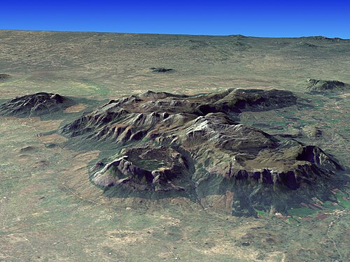
⛰️ Highest Elevation
- Map Locations: Google Maps | OpenStreetMap