🇱🇸 Lesotho
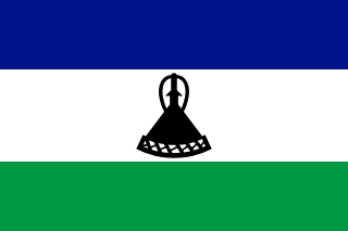 National Flag
🎵 National Anthem
Geography & Borders

Introduction & Background
Lesotho (/ləˈsuːtuː/ⓘ lə-SOO-too),7 officially the Kingdom of Lesotho, is a country landlocked as an enclave in South Africa. It is situated in the Maloti Mountains and contains the highest mountains in Southern Africa.8 It has an area of over 30,000km2 (11,600mi2) and has a population of about 2 million.
It was previously the British Crown colony of Basutoland, which declared independence from the United Kingdom on 4 October 1966. It is a fully sovereign state and is a member of the United Nations, the Commonwealth of Nations, the African Union, and the Southern African Development Community. The name Lesotho roughly translates to "land of the Sotho".910
Geography & Climate
Climate, weather, and air quality data are based on historical records for the coordinates of the capital city, Maseru.
Temperature (2025)
-5°5°15°25°35°
Jan
15.3° / 27.6°
Feb
15.6° / 25.9°
Mar
13.4° / 23.4°
Apr
9° / 18.7°
May
4.5° / 17.1°
Jun
2° / 13.9°
Jul
2.3° / 14.3°
Aug
5.1° / 18.6°
Sep
8.9° / 21.8°
Oct
9.6° / 23°
Nov
11.3° / 22.8°
Dec
13° / 24.3°
Precipitation & Snow (2025)
Rain (mm) Snow (cm)
Atmospheric Pressure (2025)
844.5-1.7Jan
845.1-1.1Feb
847.1+0.9Mar
845.8-0.4Apr
847.9+1.7May
846.1-0.1Jun
848.1+1.9Jul
846.4+0.2Aug
846.6+0.4Sep
846.20Oct
845.8-0.4Nov
845-1.2Dec
Thunderstorm Days (2025)
0Jan
0Feb
0Mar
0Apr
0May
0Jun
0Jul
0Aug
0Sep
0Oct
0Nov
0Dec
Wind Speed (2025)
Air Quality — Monthly Averages (2025)
| Metric | Jan | Feb | Mar | Apr | May | Jun | Jul | Aug | Sep | Oct | Nov | Dec |
|---|---|---|---|---|---|---|---|---|---|---|---|---|
| PM2.5 μg/m³ | 8.7 | 8.2 | 10.3 | 8.5 | 15.1 | 17.1 | 15.8 | 13.5 | 11.7 | 8.6 | 9.4 | 8.7 |
| PM10 μg/m³ | 8.8 | 8.3 | 10.3 | 8.6 | 15.3 | 17.4 | 16.1 | 13.8 | 11.8 | 8.7 | 9.5 | 8.8 |
| O₃ μg/m³ | 82.7 | 73.5 | 71 | 58.6 | 61.9 | 61.3 | 65.3 | 77.7 | 90 | 87.4 | 85.9 | 78.9 |
| NO₂ μg/m³ | 3 | 3.7 | 4.6 | 5 | 7.2 | 7.1 | 5.4 | 5.3 | 3.7 | 3.9 | 3.8 | 3.5 |
| SO₂ μg/m³ | 5.1 | 3.8 | 3.4 | 3.2 | 6.8 | 7.8 | 6.1 | 5.7 | 3.7 | 3.6 | 4.1 | 3.7 |
| CO μg/m³ | 135 | 125 | 132 | 133 | 172 | 199 | 196 | 193 | 194 | 155 | 136 | 119 |
Pollen Levels — Monthly (2025)
Pollen data is negligible or unavailable for this location.
⛰️ Highest Elevation
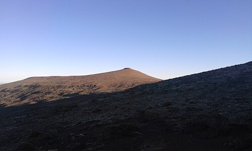
Thabana Ntlenyana3482 m / 11,424 ft
📷 Unknown
- Map Locations: Google Maps | OpenStreetMap
People & Society
Total Population2,311,472Density: 76.14 / km²
Annual Growth Rate+1.1%Moderate Growth
Life Expectancy57.38 yrsAverage lifespan at birth
Fertility Rate2.69Births per woman