🇹🇬 Togo
 National Flag
Geography & Borders


Introduction & Background
Togo (/ˈtoʊɡoʊ/ⓘ), officially the Togolese Republic (Template:Lang-fr), is a country in West Africa. It is bordered by Ghana to the west, Benin to the east and Burkina Faso to the north.8 It extends south to the Gulf of Guinea, where its capital, Lomé, is located.9 It covers about 57,000 square kilometres (22,000 square miles) with a population of approximately 8 million,10 and has a width of less than 115km (71mi) between Ghana and its eastern neighbor Benin.1112
From the 11th to the 16th century, tribes entered the region from various directions. From the 16th century to the 18th century, the coastal region was a trading center for Europeans to purchase slaves, earning Togo and the surrounding region the name "The Slave Coast". In 1884, Germany declared a region including a protectorate called Togoland. After World War I, rule over Togo was transferred to France. Togo gained its independence from France in 1960.213 In 1967, Gnassingbé Eyadéma led a successful military coup d'état, after which he became president of an anti-communist, single-party state. In 1993, Eyadéma faced multiparty elections marred by irregularities, and won the presidency three times. At the time of his death, Eyadéma was the "longest-serving leader in modern African history", having been president for 38 years.14 In 2005, his son Faure Gnassingbé was elected president.
Geography & Climate
Temperature (2025)
Precipitation & Snow (2025)
Atmospheric Pressure (2025)
Thunderstorm Days (2025)
Wind Speed (2025)
Air Quality — Monthly Averages (2025)
| Metric | Jan | Feb | Mar | Apr | May | Jun | Jul | Aug | Sep | Oct | Nov | Dec |
|---|---|---|---|---|---|---|---|---|---|---|---|---|
| PM2.5 μg/m³ | 25.5 | 19.6 | 10 | 8 | 8 | 7.2 | 12.5 | 11.3 | 9.2 | 7.3 | 8.4 | 11.1 |
| PM10 μg/m³ | 61 | 44.3 | 22.6 | 17.3 | 14.8 | 10.5 | 17.1 | 15.5 | 13.1 | 12.3 | 15.8 | 24.1 |
| O₃ μg/m³ | 88.3 | 71.8 | 56 | 50.7 | 53 | 58 | 61.8 | 53.7 | 49.6 | 49.2 | 59.6 | 64.7 |
| NO₂ μg/m³ | 1.4 | 1.3 | 1.2 | 1.5 | 1.7 | 2 | 1.5 | 1.4 | 1.8 | 2.5 | 1.6 | 1.4 |
| SO₂ μg/m³ | 0.9 | 1.1 | 1 | 0.8 | 1 | 1.1 | 1.1 | 1.2 | 1.1 | 1 | 0.7 | 0.7 |
| CO μg/m³ | 268 | 229 | 194 | 162 | 149 | 168 | 159 | 153 | 163 | 156 | 181 | 199 |
Pollen Levels — Monthly (2025)
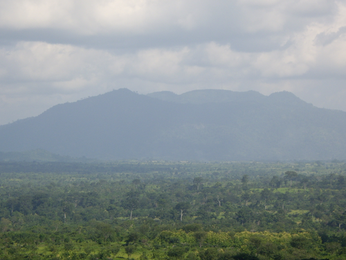
⛰️ Highest Elevation
- Map Locations: Google Maps | OpenStreetMap