🇲🇬 Madagascar
 National Flag
Geography & Borders
This country has no land borders.
Introduction & Background
Madagascar (/ˌmædəˈɡæskər, -kɑːr/; Template:Lang-mg, Template:IPA-mg), officially the Republic of Madagascar (Template:Lang-mg, Template:IPA-mg; Template:Lang-fr), is an island country in the Indian Ocean, approximately 400 kilometres (250 miles) off the coast of East Africa across the Mozambique Channel. At 592,800 square kilometres (228,900sqmi) Madagascar is the world's second-largest island country, after Indonesia.13 The nation is home to around 30 million inhabitants and consists of the island of Madagascar (the fourth-largest island in the world), along with numerous smaller peripheral islands. Following the prehistoric breakup of the supercontinent Gondwana, Madagascar split from the Indian subcontinent around 90million years ago,14 allowing native plants and animals to evolve in relative isolation. Consequently, Madagascar is a biodiversity hotspot; over 90% of its wildlife is endemic.
Human settlement of Madagascar occurred during or before the mid first millennium AD15 by Austronesian peoples, presumably arriving on outrigger canoes from present-day Indonesia.16 These were joined around the 9th century AD by Bantu migrants crossing the Mozambique Channel from East Africa.17 Other groups continued to settle on Madagascar over time, each one making lasting contributions to Malagasy cultural life. The Malagasy ethnic group is often divided into 18 or more subgroups, of which the largest are the Merina of the central highlands.
Geography & Climate
Temperature (2025)
Precipitation & Snow (2025)
Atmospheric Pressure (2025)
Thunderstorm Days (2025)
Wind Speed (2025)
Air Quality — Monthly Averages (2025)
| Metric | Jan | Feb | Mar | Apr | May | Jun | Jul | Aug | Sep | Oct | Nov | Dec |
|---|---|---|---|---|---|---|---|---|---|---|---|---|
| PM2.5 μg/m³ | 4.9 | 3.3 | 2.6 | 2.8 | 2.6 | 4.2 | 3.2 | 4.7 | 6.2 | 8 | 5.7 | 3 |
| PM10 μg/m³ | 5.2 | 3.6 | 2.8 | 3 | 3 | 4.5 | 3.6 | 5.1 | 6.6 | 8.4 | 5.9 | 3.2 |
| O₃ μg/m³ | 45.2 | 36.3 | 38.5 | 40.7 | 49.6 | 56.4 | 63.7 | 64.4 | 71.4 | 73.5 | 58.8 | 43.1 |
| NO₂ μg/m³ | 1.6 | 1.8 | 1.5 | 1.8 | 1.2 | 1.5 | 1 | 1.5 | 1.7 | 1.5 | 1.9 | 1.7 |
| SO₂ μg/m³ | 0.4 | 0.2 | 0.3 | 0.4 | 0.4 | 0.7 | 0.5 | 0.5 | 0.5 | 0.4 | 0.3 | 0.2 |
| CO μg/m³ | 136 | 140 | 115 | 119 | 110 | 126 | 120 | 127 | 152 | 161 | 170 | 129 |
Pollen Levels — Monthly (2025)
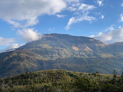
⛰️ Highest Elevation
- Map Locations: Google Maps | OpenStreetMap