World Facts Wiki
Home
Continents
Home
Continents
  • Africa

    • Africa
    • Algeria
    • Angola
    • Benin
    • Botswana
    • British Indian Ocean Territory
    • Burkina Faso
    • Burundi
    • Cameroon
    • Cape Verde
    • Central African Republic
    • Chad
    • Comoros
    • Congo
    • Djibouti
    • DR Congo
    • Egypt
    • Equatorial Guinea
    • Eritrea
    • Eswatini
    • Ethiopia
    • Gabon
    • Gambia
    • Ghana
    • Guinea
    • Guinea-Bissau
    • Ivory Coast
    • Kenya
    • Lesotho
    • Liberia
    • Libya
    • Madagascar
    • Malawi
    • Mali
    • Mauritania
    • Mauritius
    • Mayotte
    • Morocco
    • Mozambique
    • Namibia
    • Niger
    • Nigeria
    • Réunion
    • Rwanda
    • Saint Helena, Ascension and Tristan da Cunha
    • São Tomé and Príncipe
    • Senegal
    • Seychelles
    • Sierra Leone
    • Somalia
    • South Africa
    • South Sudan
    • Sudan
    • Tanzania
    • Togo
    • Tunisia
    • Uganda
    • Western Sahara
    • Zambia
    • Zimbabwe
  • All Continents

🇬🇦 Gabon

Flag of GabonNational Flag

Geography & Borders

CameroonCameroonCongoCongoEquatorial GuineaEquatorial Guinea

Introduction & Background

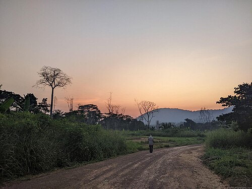
Gabon (/ɡəˈbɒn/; Template:IPA-fr; Template:Lang-snq), officially the Gabonese Republic (Template:Lang-fr), is a country on the west coast of Central Africa. Located on the equator, it is bordered by Equatorial Guinea to the northwest, Cameroon to the north, the Republic of the Congo on the east and south, and the Gulf of Guinea to the west. It has an area of nearly 270,000 square kilometres (100,000sqmi) and its population is estimated at 2.3 million people. There are coastal plains, mountains (the Cristal Mountains and the Chaillu Massif in the centre), and a savanna in the east.

Since its independence from France in 1960, the sovereign state of Gabon has had three presidents. In the 1990s, it introduced a multi-party system and a democratic constitution that aimed for a more transparent electoral process and reformed some governmental institutions. With petroleum and foreign private investment, it has the fourth highest HDI5 in the region (after Mauritius, Seychelles and South Africa) and the fifth highest GDP per capita (PPP) in all of Africa (after Seychelles, Mauritius, Equatorial Guinea and Botswana). Its GDP grew by more than 6% per year from 2010 to 2012.

Key Information
AttributeDetails
Official Name
Gabonese Republic
Capital
Libreville
Continent
Africa
Region / Subregion
Africa / Middle Africa
Population
2,469,296
Area
267,668 km²
Languages
French
Currencies
Central African CFA franc (Fr) [XAF]
Cost of Living
25 / 100 (Low)
Price per Coffee
$1.25
Price per Meal
$5.00
Timezones
UTC+01:00 (WAT)
Bounding Box
Min: (3.98° S, 8.8° E)
Max: (2.33° N, 14.43° E)
Climate
Temperate
Terrain
narrow coastal plain; hilly interior; savanna in east and south

Geography & Climate

Climate, weather, and air quality data are based on historical records for the coordinates of the capital city, Libreville.

Temperature (2025)

15°25°35°
Jan
24.1° / 29.9°
Feb
24.4° / 30.8°
Mar
24.6° / 30.6°
Apr
24.7° / 30.7°
May
24.2° / 29.8°
Jun
23.8° / 28.5°
Jul
22.9° / 27.2°
Aug
22.3° / 26.8°
Sep
23.5° / 27.6°
Oct
23.8° / 28.5°
Nov
23.5° / 29°
Dec
23.7° / 29.4°

Precipitation & Snow (2025)

275Jan
252Feb
361Mar
210Apr
269May
139Jun
16Jul
33Aug
112Sep
159Oct
399Nov
336Dec
Rain (mm) Snow (cm)

Atmospheric Pressure (2025)

1011-1.2Jan
1009.8-2.4Feb
1010.3-1.9Mar
1010.2-2Apr
1012.20May
1013.7+1.5Jun
1015.4+3.2Jul
1015.1+2.9Aug
1013.9+1.7Sep
1012.5+0.3Oct
1011.7-0.5Nov
1010.7-1.5Dec

Thunderstorm Days (2025)

0Jan
0Feb
0Mar
0Apr
0May
0Jun
0Jul
0Aug
0Sep
0Oct
0Nov
0Dec

Wind Speed (2025)

Jan
12.9
Feb
12.8
Mar
13.4
Apr
12.3
May
11.7
Jun
13.8
Jul
15.9
Aug
16.3
Sep
16.3
Oct
15.3
Nov
13.5
Dec
12.8

Air Quality — Monthly Averages (2025)

MetricJanFebMarAprMayJunJulAugSepOctNovDec
PM2.5 μg/m³10.711.89.27.17.813.914.312.99.57.46.16.6
PM10 μg/m³15.217.91410.39.917.217.616.412.310.488.5
O₃ μg/m³71.763.760.355.86172.580.567.45448.151.461
NO₂ μg/m³22.22.32.32.11.41.111.11.31.61.8
SO₂ μg/m³0.70.70.70.70.70.50.50.50.60.60.60.6
CO μg/m³229234202172162186202177174129163185

Pollen Levels — Monthly (2025)

Pollen data is negligible or unavailable for this location.

⛰️ Highest Elevation

Mont Bengoué
▲
Mont Bengoué1070 m / 3,510 ft
📷 Unknown

  • Map Locations: Google Maps | OpenStreetMap

People & Society

Total Population2,484,789Density: 9.64 / km²
Annual Growth Rate+2.2%Rapid Growth
Life Expectancy68.34 yrsAverage lifespan at birth
Fertility Rate3.65Births per woman


← Back to Africa

Prev
Ethiopia
Next
Gambia