🇧🇯 Benin
 National Flag
Geography & Borders


Introduction & Background
Benin (/bɛˈniːn/ⓘ ben-EEN, /bɪˈniːn/ bin-EEN;9 Template:Lang-fr Template:IPA-fr, Template:Lang-ff), officially the Republic of Benin (Template:Lang-fr), and formerly Dahomey,10 is a country in West Africa. It is bordered by Togo to the west, Nigeria to the east, Burkina Faso to the north-west, and Niger to the north-east. The majority of its population lives on the southern coastline of the Bight of Benin, part of the Gulf of Guinea in the northernmost tropical portion of the Atlantic Ocean.11 The capital is Porto-Novo, and the seat of government is in Cotonou, the most populous city and economic capital.citation needed Benin covers an area of 114,763 square kilometres (44,310sqmi)4 and its population in 2021 was estimated to be approximately 13 million.1213 It is a tropical nation, dependent on agriculture, and is an exporter of palm oil and cotton. Some employment and income arise from subsistence farming.14bettersourceneeded
The official language of Benin is French, with indigenous languages such as Fon, Bariba, Yoruba and Dendi also spoken. The largest religious group in Benin is Sunni Islam (27.7%), followed by Roman Catholicism (25.5%), Vodun (11.6%), and Protestantism.2 Benin is a member of the United Nations, the African Union, the Economic Community of West African States, the Organisation of Islamic Cooperation, the South Atlantic Peace and Cooperation Zone, Francophonie, the Community of Sahel–Saharan States, the African Petroleum Producers Association and the Niger Basin Authority.
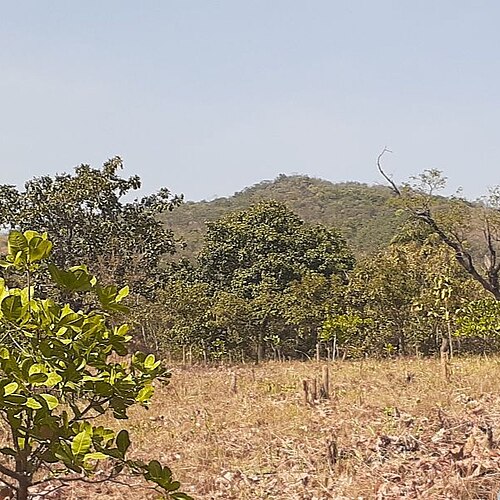
Geography & Climate
Temperature (2025)
Precipitation & Snow (2025)
Atmospheric Pressure (2025)
Thunderstorm Days (2025)
Wind Speed (2025)
Air Quality — Monthly Averages (2025)
| Metric | Jan | Feb | Mar | Apr | May | Jun | Jul | Aug | Sep | Oct | Nov | Dec |
|---|---|---|---|---|---|---|---|---|---|---|---|---|
| PM2.5 μg/m³ | 30.2 | 20.3 | 9.9 | 8 | 9.5 | 7.6 | 11.3 | 10.1 | 8.5 | 9 | 10.1 | 12.2 |
| PM10 μg/m³ | 71.6 | 47.8 | 22.9 | 16.6 | 16.4 | 10.6 | 14.8 | 13.1 | 11.4 | 14.2 | 17.8 | 26.6 |
| O₃ μg/m³ | 94.9 | 74.8 | 57.1 | 50.8 | 51.2 | 57.6 | 61.7 | 54 | 50.6 | 51.5 | 62.6 | 67.1 |
| NO₂ μg/m³ | 3.1 | 2.4 | 2 | 2.7 | 3.4 | 3.3 | 2.2 | 2.1 | 2.9 | 4.6 | 3.7 | 2.7 |
| SO₂ μg/m³ | 0.9 | 0.7 | 0.6 | 0.6 | 0.8 | 0.8 | 0.8 | 0.9 | 0.8 | 0.9 | 0.7 | 0.6 |
| CO μg/m³ | 285 | 242 | 201 | 159 | 149 | 163 | 161 | 155 | 163 | 155 | 188 | 201 |
Pollen Levels — Monthly (2025)
⛰️ Highest Elevation
- Map Locations: Google Maps | OpenStreetMap