🇼🇫 Wallis and Futuna
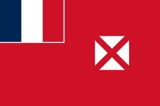 National Flag
Geography & Borders
This country has no land borders.
Introduction & Background
Wallis and Futuna, officially the Territory of the Wallis and Futuna Islands3 (/ˈwɒlɪs...fuːˈtuːnə/; Template:Lang-fr Template:IPA-fr or Territoire des îles Wallis-et-Futuna, Fakauvea and Fakafutuna: ʻUvea mo Futuna), is a French island collectivity in the South Pacific, situated between Tuvalu to the northwest, Fiji to the southwest, Tonga to the southeast, Samoa to the east, and Tokelau to the northeast.
Mata Utu is its capital and largest city. Its land area is 142.42km2 (54.99sqmi). It had a population of 11,558 at the 2018 census (down from 14,944 at the 2003 census).14 The territory is made up of three main volcanic tropical islands and a number of tiny islets. It is divided into two island groups that lie about 260km (160mi) apart: the Wallis Islands (also known as Uvea) in the northeast; and the Hoorn Islands (also known as the Futuna Islands) in the southwest, including Futuna Island proper and the mostly uninhabited Alofi Island.
Geography & Climate
Temperature (2025)
Precipitation & Snow (2025)
Atmospheric Pressure (2025)
Thunderstorm Days (2025)
Wind Speed (2025)
Air Quality — Monthly Averages (2025)
| Metric | Jan | Feb | Mar | Apr | May | Jun | Jul | Aug | Sep | Oct | Nov | Dec |
|---|---|---|---|---|---|---|---|---|---|---|---|---|
| PM2.5 μg/m³ | 5.9 | 5.8 | 4.6 | 4.5 | 5.3 | 6.8 | 6.1 | 7.2 | 6.4 | 6.3 | 4.5 | 4.2 |
| PM10 μg/m³ | 9.3 | 9.4 | 7.6 | 7.5 | 8.9 | 11.2 | 10.2 | 11.9 | 10.6 | 10.6 | 7.3 | 6.7 |
| O₃ μg/m³ | 29.4 | 28.5 | 21.9 | 29.5 | 33.3 | 46.4 | 50.6 | 46.2 | 51.2 | 42.4 | 32.2 | 27.4 |
| NO₂ μg/m³ | 0 | 0 | 0 | 0 | 0 | 0 | 0 | 0 | 0 | 0 | 0 | 0.1 |
| SO₂ μg/m³ | 0.2 | 0.2 | 0.1 | 0.1 | 0.1 | 0.2 | 0.2 | 0.2 | 0.2 | 0.1 | 0.2 | 0.2 |
| CO μg/m³ | 81 | 84 | 73 | 74 | 76 | 76 | 78 | 79 | 82 | 87 | 85 | 78 |
Pollen Levels — Monthly (2025)
⛰️ Highest Elevation
- Map Locations: Google Maps | OpenStreetMap